
[imagesource: NASA Earth Observatory]
The year 2024 shattered records but for all the wrong reasons.
In July, Earth’s average temperature soared to the highest level in over 175 years, with July 22 marking the hottest day ever recorded. This (Northern Hemisphere) summer scorched its way into the history books as the hottest since around 1880, while the hurricane season kicked off with a bang—Beryl, the earliest Category 4 hurricane ever documented.
Here in South Africa’s winter, we received record-breaking rainfall and freak storms, some snowy even.
To top it off, a June report confirmed what many feared: human-driven global warming has reached an alarming, all-time high.
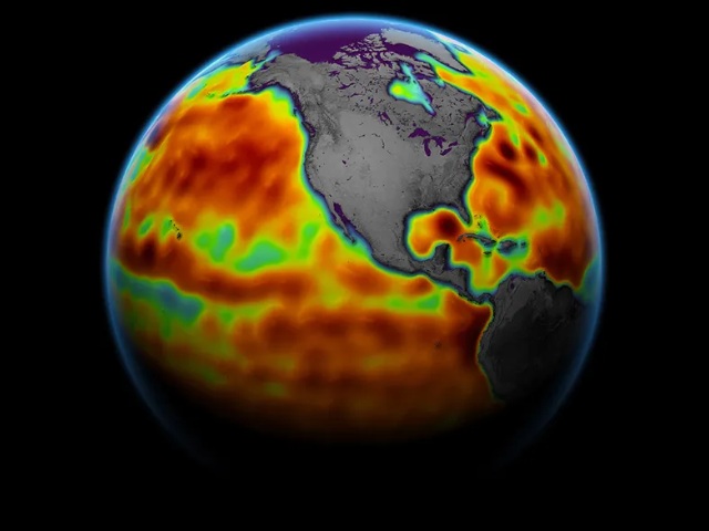
As Space.com reported earlier this month, human-induced climate change is driving planetary heating, causing glaciers to melt at “unprecedented rates.” This surge in melting ice is fueling rising sea levels, leaving coastal communities vulnerable to storm devastation and displacing countless animals from their natural habitats.
Last month, Hurricane Helene destroyed communities across the southeastern coast of the United States, and Hurricane Milton brought another devastating impact to South Florida this month. The strength of these storms is directly connected to climate change. Here in South Africa, the eastern and western coast is battered by increasingly more dramatic weather, with the toxic cycle of flooding and drought really ramping up.
NASA and other space agencies are harnessing climate satellites to track the dramatic impact of climate change on weather patterns. Using satellite gravimetry—a technique that Space.com describes as capable of “precisely measuring ice mass loss, rising oceans, and even shifts in groundwater supply”—scientists are uncovering the full extent of the danger. These shifts pose an escalating threat to coastal towns across the globe, signalling a growing crisis.
“Satellites can see what we cannot with our own eyes: changes in deep underground water storage that would require us to dig deep in the ground to witness firsthand,” Cedric David, a scientist at NASA’s Jet Propulsion Laboratory (JPL) in Southern California, told Space.com.
“That’s just mind-blowing.”
Scientists have long sounded the alarm on rising sea levels and the peril they present to coastal cities. The Intergovernmental Panel on Climate Change has predicted that by 2100, sea levels could surge between 0.43 metres and 0.85 metres, which although seemingly low, would have devastating consequences for regions by the sea.
The hope is that scientists can use the data gathered from climate satellites as evidence to influence climate-impacting decisions and convince officials that change is necessary to reduce pollution in hopes of slowing down the heating of the planet.
“We’ve had a series of radar altimetry satellites circling around our Earth in constant operation since 1992 that have allowed us to see the undeniable: Oceans are in constant rise,” David told Space.com. “The 30-year-long curves of sea level rise are unquestionable evidence that our climate is changing.”
It is advised for those living in coastal communities to brace for the impact of extreme weather events by taking steps to build climate resistance in their home.
[source:thecooldown]